Source Data Coordinate System
The Source coordinate system is usually detected when the coordinate system information is available with the GIS data being imported and when supported in the native GIS format (e.g. Shapefile). However, in some cases, this information is not imported because it is not supported in the original GIS format (e.g. DWG, DXF) or when using non-referenced Adobe Illustrator files. In that case, the coordinate system must be specified by the user. It generally can be found from an attached metadata document, by contacting the data provider, or in textual information on the original data itself (e.g. title or legend of a scanned map).
In all cases, the source coordinate system must be known with certainty. Only then can the proper parameter be specified in the MAPublisher interface. A wrongly specified source coordinate system would make the map data unusable for transformations and merging with other datasets.
Final Map Coordinate System
Most cartographic projects are restricted in the choice of a coordinate system for the final map. This parameter is usually part of the project requirement. It is the task of the professional cartographer to analyze the situation carefully to make a wise decision. For general-purpose mapping projects (interpretive or marketing maps for example), a more approximate selection of the coordinate systems might be acceptable. Following the request from some of our users, who may not have cartographic expertise, here is a list of simple considerations to take into account before making a choice:
Use of a Geodetic Coordinate system (angular coordinates, Lat/Long)
•Appropriate for overlay with GPS data recorded in Lat/Long format.
•WGS84 system is required to export vector data to KML format (for display in Google Earth, Google Maps).
Use of a Projected coordinate system
•Appropriate for printed maps (so that users can use a ruler to measure distances on the map).
•Required to add a scale bar.
Use of a particular system (within the list of projected and geodetic systems)
•Maps that are part of a portfolio or Atlas have to comply with the same system to be consistent.
•When a georeferenced image (GeoTIFF or World TIFF) is to be used together with the data, it is easier to use the same coordinate system for the vector data as of the raster.
•Most countries or geographic areas have published standards or usual ways for representing the land (e.g. for road maps or meteorological maps). In this case, the user should make some tests with the systems listed in MAPublisher. For convenient use, coordinate systems are sorted by continent>country>sub-division (state or county for example).
When in doubt, it is recommended to test different coordinate systems and visualize the results.
For more information on the supported coordinate systems and projections in MAPublisher, please refer to the Avenza Projections Guide installed with MAPublisher.
Coordinate System Examples
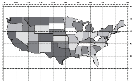
WGS84 Coordinate System (Geodetic > World > WGS84) (unprojected)
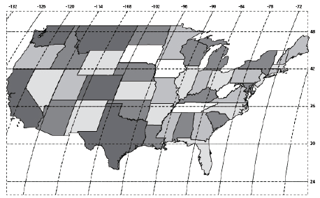
Robinson Coordinate System (Projected > World > Robinson)
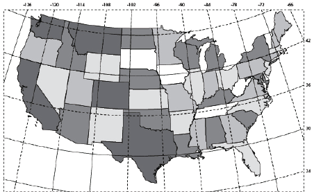
Projected (Projected > North America > United States > US National Atlas)
Comments
0 comments
Please sign in to leave a comment.